Wisconsin Shipwreck Coast National Marine Sanctuary

Protected marine area in Lake Michigan off Wisconsin, United States
44°00′N 87°36′W / 44.0°N 87.6°W / 44.0; -87.6 and vicinity[1]Area726 sq nmi (962 sq mi; 2,490 km2)Established2021Governing bodyNOAA Office of National Marine Sanctuariessanctuaries.noaa.gov/wisconsin/
NOAA map of the Wisconsin Shipwreck Coast National Marine Sanctuary. Red stars indicate shipwrecks on the National Register of Historic Places, red dots are other known shipwrecks, and green dots indicate potential locations of undiscovered shipwrecks.
Lakebed mapping image of the sanctuary

The Wisconsin Shipwreck Coast National Marine Sanctuary is one of 15 United States National Marine Sanctuaries[2] administered by the National Oceanic and Atmospheric Administration (NOAA), an agency of the United States Department of Commerce; NOAA co-manages the sanctuary jointly with the State of Wisconsin. It is located in Lake Michigan along the coast of Wisconsin. It was created in 2021 to protect shipwrecks considered nationally important archaeological resources.[3]

Description

The Wisconsin Shipwreck Coast National Marine Sanctuary covers approximately 726 square nautical miles (962 sq mi; 2,490 km2)[3][4][5][6] in Lake Michigan off Wisconsin's Ozaukee, Sheboygan, Manitowoc, and Kewaunee counties.[4] It includes approximately 82 miles (132 km) of Wisconsin′s coast[4] and lies entirely within the state waters of Wisconsin,[4] extending approximately 7 to 16 miles (6.1 to 13.9 nmi; 11 to 26 km) from the coast.[4] Principal cities along the coast include Port Washington, Sheboygan, Manitowoc, and Two Rivers, Wisconsin.[4][6]

At the time of its designation in 2021, the sanctuary included 36 known shipwrecks[3][5][6][4] dating from the 1830s to the 1930s,[5] including Wisconsin's two oldest known shipwrecks in terms of vessel construction date,[4][6] the schooners Gallinipper, which was constructed in 1833 and sank in 1851, and Home, which was built in 1843 and sank in 1858.[7][8][9] The wrecks provide a cross-section of the types of ships that connected Wisconsin with other Great Lakes ports between the early 1800s and the 20th century.[6] Archival research indicated that the sanctuary could include another 59 or 60 such shipwrecks (sources provide both figures) that had yet to be discovered.[3][4][5][6] Twenty-one of the known shipwrecks were listed on the National Register of Historic Places.[4][5][6] Thanks to the cold, fresh water of Lake Michigan, several of the known shipwrecks were essentially intact and looked much like they did when they sank.[4][5][6]

NOAA and the State of Wisconsin jointly manage the sanctuary.[2][3][4][5][6]

History

Designation

NOAA Commissioned Officer Corps Navigation Response Team officers speak with U.S. Senator Tammy Baldwin and NOAA Administrator Dr. Rick Spinrad at the Wisconsin Maritime Museum in Manitowoc, Wisconsin, during the ceremony finalizing and celebrating the establishment of the Wisconsin Shipwreck Coast National Marine Sanctuary.

In 2008, the Wisconsin Historical Society published a report titled "Wisconsin's Historic Shipwrecks: An Overview and Analysis of Locations for a State/Federal Partnership with the National Marine Sanctuary Program, 2008."[4] Drawing on this report, the State of Wisconsin on December 2, 2014, submitted a nomination asking NOAA to consider designating the area as a national marine sanctuary.[4][10] On February 5, 2015, NOAA added the area to its inventory of nominated areas eligible for designation as national marine sanctuaries.[4] On October 7, 2015, NOAA announced its intention to designate the area as a sanctuary,[3][4][10] initiating a 90-day public comment period during which NOAA held three public meetings on the designation in November 2015.[10] On January 9, 2017, NOAA published a notice of its intention to designate a 1,075-square-mile (2,780 km2) area[4] as the Wisconsin-Lake Michigan National Marine Sanctuary, continaing the sites of 37 known historic shipwrecks.[4][10] An 81-day public comment period and a series of four meetings in the Wisconsin towns of Algoma, Manitowoc, Sheboygan, and Port Washington during the week of March 13, 2017, followed which led NOAA to alter the sanctuary's boundaries, reducing its area to 926 square miles (2,400 km2), including 36 known historic shipwrecks, and to change its name to Wisconsin Shipwreck Coast National Marine Sanctuary.[4][10] NOAA published an environmental impact statement and final management plan in June 2020,[3][10] designated the area as a sanctuary on June 22, 2021,[6] and published the designation in the Federal Register on June 23, 2021.[4][10] The designation was to take effect formally in the autumn of 2021[5] following 45 days of continuous session of the United States Congress after publication of the designation in the Federal Register.[4][6] After the 45-day review period in Congress and by the Governor of Wisconsin was complete, the designation became effective on August 16, 2021.[10] The designation was finalized and celebrated in ceremony attended by U.S. Senator Tammy Baldwin, Governor of Wisconsin Tony Evers, NOAA Administrator Dr. Rick Spinrad, and local officials at the Wisconsin Maritime Museum in Manitowoc on October 9, 2021.[11][12] The Wisconsin Shipwreck Coast National Marine Sanctuary was the first national marine sanctuary created in the United States since the designation of Mallows Bay, Maryland, as a sanctuary in 2019.[6]

Upon designating the area as a sanctuary, NOAA announced that it would stay a prohibition on grappling into or anchoring on shipwreck sites in the sanctuary until October 1, 2023.[4] The delay in the imposition of this regulation was intended to give NOAA time to install mooring buoys that would make anchoring or grappling unnecessary, establish policies allowing access to shipwrecks where mooring buoys would not be installed, and explore the possibility of allowing some diving activities it originally intended to prohibit, such as allowing divers to attach mooring lines directly to some shipwrecks.[4] The designation is the second of its kind for the Great Lakes and the first for Lake Michigan.[13]

2021

A University of Delaware graduate student launches an autonomous underwater vehicle in the Wisconsin Shipwreck Coast National Marine Sanctuary in the summer of 2021.

The NOAA Office of Coast Survey began a survey of the sanctuary's waters in June 2021 to collect data in support of nautical charting of the waters and archaeological studies of cultural resources in the sanctuary, but mechanical problems forced a delay.[12] The survey resumed in early October 2021.[12] By the time it concluded on October 22, the NOAA team had surveyed 70 square miles (53 sq nmi; 180 km2) of the lakebed near Manitowoc and Sheboygan, including four known shipwrecks.[12][14]

During 2021, the sanctuary installed three real-time wind-and-wave buoys also capable of providing real-time water temperatures at different depths in sanctuary waters off Port Washington, Sheboygan, and Two Rivers.[14][15] The buoys were intended to enhance boating safety and fishing in the sanctuary.[15] The sanctuary also teamed with its research partners to use autonomous underwater vehicles to explore sanctuary waters off Two Rivers as part of a NOAA-led search for maritime heritage resources in Lake Michigan and Lake Ontario between July 28 and August 20, 2021.[14][16]

2022

Still image of a photogrammetric model of the wreck of the schooner Northerner created from imagery taken by NOAA personnel in the Wisconsin Shipwreck Coast National Marine Sanctuary on June 11, 2022

During 2022, the NOAA Office of Coast Survey awarded a contract for a high-resolution, sonar-based mapping of most of the sanctuary′s lakebed, following up on the pilot mapping project carried out in 2021.[15] The sanctuary also participated in the creation of a podcast and digital short promoting tourism in the communities along Wisconsin′s mid-Lake Michigan coast[15] and co-sponsored a hands-on learning experience about marine technology and archaeology for 20 Wisconsin teachers from the Manitowoc-Two Rivers area, Milwaukee, and Green Bay.[15] By 2022, a study was underway to explore the creation of a NOAA facility along the Wisconsin coast to support the sanctuary.[15]

In June 2022, a NOAA Office of National Marine Sanctuaries team conducted maritime archaeological assessments at 11 shipwreck sites and sonar mapping at 13 sites and collected 6k video and virtual reality footage to collect data in support of resource monitoring, mooring buoy, and education and outreach programs in the sanctuary.[14]

In August 2022, the sanctuary began accepting applications to serve on its 15-seat advisory council, made up of members of the local community, with applications due by October 1, 2022. The creation of an advisory council is a standard practice for U.S. national marine sanctuaries.[17]

2023

In September 2023, maritime historicans announced the July 2023 discovery of the wreck of the 140-foot (43 m) American schooner Trinidad, which sank on May 11, 1881, in 270 feet (82 m) of water off the coast of Wisconsin near Algoma. The wreck was in "pristine" condition, but lies just outside the national marine sanctuary, prompting its discoverers to make plans to work with the Wisconsin Historical Society to request its addition to the National Register of Historic Places in order to increase its visibility as an historically important shipwreck and to ensure its protection.[18]

NOAA′s plans to install mooring buoys in the sanctuary during the summer of 2023 went unfulfilled because NOAA's partner organizations were unable to provide ship time for the buoy installation effort. On September 29, 2023, the NOAA Office of National Marine Sanctuaries extended the stay on the prohibition of grappling into or anchoring on shipwreck sites in the sanctuary from October 1, 2023, to October 1, 2024, to allow an additional year to address public comments on the effect of the prohibition on commercial shipping and engage in outreach to educate the public on the location of shipwrecks and non-destructive means for mooring to them, as well as to delay the prohibition until after the installation of mooring buoys, which NOAA rescheduled for the summer of 2024.[19]
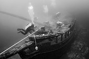
Gallery

Shipwrecks in the Wisconsin Shipwreck Coast National Marine Sanctuary
  • A pattern of submerged, log-like objects
    The schooner Advance on June 9, 2022
  • View looking forward of the bow of a shipwreck
    Bow section of the schooner America on June 13, 2022
  • Overhead view of a submerged ship's bow area
    Bow section of the schooner Mahoning on June 11, 2022
  • Submerged ship's bow area
    The schooner Northerner on May 6, 2010
  • Submerged box-like structure
    The steam engine of the steam barge Selah Chamberlain on June 13, 2022

References

  1. ^ Approximation based on coordinates at "Wisconsin Shipwreck Coast National Marine Sanctuary Designation; Final Regulations". NOAA via Federal Register. June 23, 2021. Retrieved 29 June 2021.
  2. ^ a b National Marine Sanctuaries press release: Wisconsin Shipwreck Coast National Marine Sanctuary Accessed 29 June 2021
  3. ^ a b c d e f g National Marine Sanctuaries: Wisconsin Shipwreck Coast National Marine Sanctuary Accessed 29 June 2021
  4. ^ a b c d e f g h i j k l m n o p q r s t u v w "Wisconsin Shipwreck Coast National Marine Sanctuary Designation; Final Regulations". NOAA via Federal Register. June 23, 2021. Retrieved 29 June 2021.
  5. ^ a b c d e f g h National Marine Sanctuaries media document: Wisconsin Shipwreck Coast National Marine Sanctuary Accessed 29 June 2021
  6. ^ a b c d e f g h i j k l NOAA News "NOAA designates new national marine sanctuary in Wisconsin’s Lake Michigan," June 22, 2021 Accessed 29 June 2021
  7. ^ Haun, Eric, "Proposed Sanctuaries Aim to Protect Historic Shipwrecks," Marine Technology News January 6, 2017 Accessed 1 July 2021
  8. ^ Wisconsin Shipwrecks: GALLINIPPER (1832) Accessed 1 July 2021
  9. ^ Wisconsin Shipwrecks: HOME (1843) Accessed 1 July 2021
  10. ^ a b c d e f g h "History of the Wisconsin Shipwreck Coast NMS Designation," noaa.gov Accessed September 5, 2023
  11. ^ Krall, Annie, et al., "NOAA, state leaders celebrate final designation of Shipwreck Coast National Marine Sanctuary," WBAY.com, October 9, 2021 Accessed 23 October 2021
  12. ^ a b c d Anonymous, "Navigation Response Team attends National Marine Sanctuary designation," Coast Survey Biweekly Newsletter (NOAA), October 27, 2021 Accessed September 5, 2023
  13. ^ "Dozens of Shipwreck Discoveries Anticipated in New Marine Sanctuary". Scientific American. 11 November 2021. Retrieved 18 November 2021.
  14. ^ a b c d National Marine Sanctuaries — Wisconsin: Science Accessed September 5, 2021
  15. ^ a b c d e f Green, Russ, and Mike Friis, "The Wisconsin Shipwreck Coast National Marine Sanctuary is an investment in our past and future," Wisconsin Great Lakes Chronicle, 2022, p. 10.
  16. ^ NOAA Ocean Exploration: "Maritime Heritage in America’s Inland Seas: A Multi-Tiered Autonomous Vehicle-Based Survey of Two Proposed Great Lakes National Marine Sanctuaries;" "Maritime Heritage in America's Inland Seas: Expedition Overview," noaa.gov Accessed September 5, 2023
  17. ^ Denman, Katie, "NOAA Seeks Applicants for Wisconsin Shipwreck Coast National Marine Sanctuary Advisory Council," NOAA National Marine Sanctuaries, August 2022 Accessed September 5, 2023
  18. ^ Clough, Christopher; Encinas, Amaris (September 5, 2023). "'A time capsule': 156-year-old sunken ship found in pristine condition in Lake Michigan". USA Today. Retrieved September 8, 2023.
  19. ^ "Designation of Wisconsin Shipwreck Coast National Marine Sanctuary; Delay of Effectiveness". Federal Register. National Archives and Records Administration. 29 September 2023. Retrieved 11 October 2023.

External links

  • Official website
  • NOAA video "Designation of Wisconsin Shipwreck Coast National Marine Sanctuary" on YouTube
  • NOAA video "Wisconsin Shipwreck Coast National Marine Sanctuary B-roll" on YouTube
  • NBC 26 video "Wisconsin Shipwreck Coast becomes the 15th National Marine Sanctuary" on YouTube
  • NOAA video "Wisconsin Shipwreck Coast National Marine Sanctuary Educators at Sea" on YouTube
  • v
  • t
  • e
Federal
National Park Service
National Forests
National Wildlife Refuges
National Trails
National Estuarine Research Reserves
National Marine Sanctuaries
  • Wisconsin Shipwreck Coast
National Wild and Scenic Rivers
  • St. Croix River
  • Wolf River
National Wilderness Preservation System
State
State Parks
State Natural Areas
  • Ableman's Gorge
  • Abraham's Woods
  • Adiantum Woods
  • Albany Sand Prairie & Oak Savanna
  • Allen Creek Wetlands
  • Allequash Lake
  • Alvin Creek Headwaters
  • Ancient Aztalan Village
  • Anvil Lake Trail
  • Apostle Islands Critical Species
  • Apostle Islands Maritime Cliffs
  • Apostle Islands Maritime Forest
  • Apostle Islands Sandscape
  • Apostle Islands Yew Forest
  • Apple River Canyon
  • Arbutus Oaks
  • Arena Pines and Sand Barrens
  • Argonne Experimental Forest
  • Atkins Lake & Hiles Swamp
  • Audubon Goose Pond
  • Aurora Lake
  • Avoca River-Bottom Prairie
  • Avon Bottoms
  • Badfish Creek Wet Prairie & Spring Seeps
  • Baileys Harbor Boreal Forest and Wetlands
  • Bakken's Pond
  • Baraboo River Floodplain Forest
  • Bark Bay Slough
  • Barksdale Ponds
  • Barneveld Prairie
  • Barney Creek
  • Bass Hollow
  • Bass Lake Fen
  • Bass Lake Peatlands
  • Bass Lake Preserve
  • Bastile Lake
  • Battle Bluff Prairie
  • Battle Creek Hemlocks
  • Bauer-Brockway Barrens
  • Baxter's Hollow
  • Bay City Mine
  • Bayshore Blufflands
  • Bean Lake
  • Bear Beach
  • Bear Bluff
  • Bear Caves
  • Bear Creek Cave
  • Bear Creek Hemlocks
  • Bear Creek Sedge Meadow
  • Bear Lake Sedge Meadow
  • Bear Lake Slough
  • Bearsdale Creek & Hyatt Springs
  • Beaver Brook
  • Beaver Creek
  • Belden Swamp
  • Belmont Mound
  • Belmont Prairie
  • Berg Prairie and Billy Goat Ridge
  • Bergen Bluffs
  • Berlin Fen
  • Beulah Bog
  • Bibon Swamp
  • Big and Little Marsh
  • Big Bay Sand Spit and Bog
  • Big Beaver Meadow
  • Big Eau Pleine Woods
  • Big Island
  • Big Manitou Falls
  • Big Rock Pines
  • Big Swamp
  • Big Swamp Tamarack Fen
  • Bittersweet Lakes
  • Black Creek Bog
  • Black Earth Rettenmund Prairie
  • Black Lake Bog
  • Black River Savanna
  • Black Tern Bog
  • Blackhawk Island
  • Blackjack Springs
  • Bloch Oxbow
  • Blomberg Lake
  • Blue Hills Felsenmeer
  • Blue River Bluffs
  • Blue River Sand Barrens
  • Blue Swamp
  • Blueberry Swamp
  • Blueberry Trail
  • Bluff Creek
  • Bogus Swamp
  • Bohn Lake
  • Bonita Country
  • Borah Creek Prairie
  • Border Lakes
  • Borst Valley Sedge Meadow
  • Boscobel Bluffs
  • Bradley Creek Swamp Conifers
  • Brady's Bluff Prairie
  • Brant Brook Pines
  • Brockway Ponds
  • Brooks Bluff
  • Browntown Oak Forest
  • Brule Glacial Spillway
  • Brule River Boreal Forest
  • Brule River Cliffs
  • Brule Rush Lake
  • Brunsweiler River and Mineral Lake
  • Brush Creek Hemlocks
  • Buckhorn Barrens
  • Buena Vista Prairie Chicken Meadow
  • Buena Vista Quarry Prairie
  • Buffalo River Trail Prairies
  • Butler Lake and Flynn's Spring
  • Cady's Marsh
  • Camp Five Lake
  • Camp Lake and Pines
  • Camp Nine Pines
  • Camp Three Lake
  • Canoe Landing Prairie
  • Caroline Lake
  • Carver-Roehl Woods
  • Caryville Savanna
  • Cassville Bluffs
  • Castle Mound Pine Forest
  • Catfish Eddy Terraces
  • Cathedral Pines
  • Catherine Lake Hemlock-Hardwoods
  • Cave Point-Clay Banks
  • Cedar Grove Hawk Research Station
  • Cedarburg Beech Woods
  • Cedarburg Bog
  • Centennial Bedrock Glade
  • Charles Pond
  • Chequamegon Hardwoods
  • Cherney Maribel Caves
  • Cherokee Marsh
  • Cherry Lake Sedge Meadow
  • Chimney Rock Oak Opening
  • Chippewa Moraine Lakes
  • Chippewa Trail
  • Chiwaukee Prairie
  • Chub and Mud Lake Riverine Marsh
  • Chub Lake Oak Savanna
  • Clifford Messinger Dry Prairie & Savanna Preserve
  • Clover Valley Fen
  • Coffee Swamp
  • Comstock Bog-Meadow
  • Coon Creek Cliffs
  • Coon Fork Barrens
  • Copper Falls
  • County Line Barrens and Forest
  • Cranberry Creek Mound Group
  • Crandon Ribbed Fen
  • Crex Sand Prairie
  • Crooked Lake Wetlands
  • Cudahy Woods
  • Cylon
  • Dalles of the St. Croix River
  • Day Lake
  • Deansville Fen
  • Deer Creek Tamarack Bog
  • Deer Fly Swamp
  • Deer Island
  • Deer Mountain
  • Dells of the Eau Claire River
  • Dells of the Wisconsin River
  • Detroit Harbor
  • Devil's Backbone
  • Devil's Lake Oak Forest
  • Devine Lake & Mishonagon Creek
  • Dewey Heights Prairie
  • Dewey Marsh
  • Diamond Lake
  • Diamond Roof
  • Doering Woods
  • Dorothy Lake
  • Dory's Bog and Hunt Hill
  • Drummond Woods
  • Dry Lake
  • Dunbar Barrens
  • Dunn Lake
  • Dunnville Barrens
  • Dupage Lake Peatlands
  • Durst Rockshelter
  • Dwight's Point and Pokegama Wetlands
  • Eagle Centre Prairie
  • Eagle Eye
  • Eagle Oak Opening
  • East Bluff
  • East Fork Chippewa River
  • East Fork of the Black River
  • Echo Lake
  • Eighteen Mile Creek
  • Ekdall Wetlands
  • Elk River Valley
  • Ellison Bluff
  • Emmons Creek Barrens
  • Empire Prairies
  • Empire Swamp
  • English Lake Hemlocks
  • Enterprise Hemlocks
  • Ericson Creek Forest and Wetlands
  • Eureka Maple Woods
  • Europe Bay Woods
  • Fair Meadows
  • Fairy Chasm
  • Fairyland
  • Farmington Bottoms
  • Faville Prairie
  • Fern Dell Gorge
  • Ferry Bluff
  • Finnerud Pine Forest
  • Fish Lake Meadow
  • Fish Lake Pines
  • Five Mile Barrens
  • Five-Mile Bluff Prairie
  • Flambeau River Hardwood Forest
  • Flambeau Wetlands
  • Flat Lake
  • Flora Spring Pond
  • Flume Creek Cedars
  • Forbes Springs
  • Fort McCoy
  • Foulds Creek
  • Fountain Creek Wet Prairie
  • Fourmile Island Rookery
  • Fox Maple Woods
  • Franklin and Butternut Lakes
  • Franklin Savanna
  • French Creek Fen
  • French Creek North
  • Frog Lake and Pines
  • Gasner Hollow Prairie
  • Genesse Oak Opening and Fen
  • Germain Hemlocks
  • Germania Wet Prairie
  • Ghost Lake
  • Giant White Pine Grove
  • Gibraltar Rock
  • Glenn Creek Barrens
  • Glocke Lake
  • Gobler Lake
  • Goose Lake
  • Goose Lake Drumlins
  • Gotham Jack Pine Barrens
  • Grand Island
  • Grandma Lake
  • Grassy Lake
  • Great River Trail Prairies
  • Hagar Mountain
  • Haley Creek Swamp
  • Half Moon Bottoms
  • Hanson Lake Wetlands
  • Hardscrabble Prairie
  • Haskell Noyes Memorial Woods
  • Hawkins Hemlock-Hardwood Forest
  • Hawkinson Creek Wet Prairie
  • Haymeadow Creek
  • Haymeadow Flowage
  • Headwater Lakes
  • Hedmark Pines
  • Hemlock Draw
  • High Cliff Escarpment
  • Highway K Woods
  • Hiles Wetlands
  • Hog Island Tamaracks
  • Hogback Prairie
  • Holland Red Maple Swamp
  • Holland Sand Prairie
  • Holmboe Conifer Forest
  • Honey Creek
  • Hook Lake Bog
  • Hortonville Bog
  • Houghton Falls
  • Hub City Bog
  • Huiras Lake
  • Hulburt Creek Woods
  • Hunting River Alders
  • Inch Lake
  • Interstate Lowland Forest
  • Ipswich Prairie
  • Island Lake Hemlocks
  • Jackson Creek Woods
  • Jackson Harbor Ridges
  • Jackson Marsh
  • Jay Creek Pine Forest
  • Jean Brunet Woods
  • Jefferson Tamarack Swamp
  • Johnson Falls
  • Johnson Hill Kame
  • Johnson Lake Barrens
  • Jones Lake
  • Jump River Woods
  • Jung Hemlock-Beech Forest
  • Kamrath Creek Forest and Fen
  • Kangaroo Lake
  • Karcher Springs
  • Karner Blue Meadow
  • Keller Whitcomb Creek Woods
  • Kelly Lake Hemlocks
  • Kelly Lynn Bog
  • Kentuck Lake
  • Kessler Railroad Prairie
  • Ketchum Creek Pines
  • Kettle Hole Woods
  • Kettle Moraine Low Prairie
  • Kettle Moraine Oak Opening
  • Kettle Moraine Red Oaks
  • Kewaskum Maple-Oak Woods
  • Kickapoo Valley Reserve
  • Kickapoo Wild Woods
  • Kidrick Swamp
  • Kieper Creek
  • Kingston Pines
  • Kinnickinnic River Gorge and Delta
  • Kinnickinnic Wet Prairie
  • Kirby Lake Hardwoods
  • Kissick Alkaline Bog Lake
  • Kohler Park Dunes
  • Kohler-Peet Barrens
  • Koro Prairie
  • Koshkonong Corners
  • Kroenke Lake
  • Krueger Pines
  • Kurtz Woods
  • La Crosse River Trail Prairie
  • LaFave Swamp
  • Lake Alva Birch-Hemlock
  • Lake Evelyn
  • Lake Helane
  • Lake Lackawanna
  • Lake Laura Hardwoods
  • Lake Noquebay Sedge Meadow
  • Lake of the Pines Conifer-Hardwoods
  • Lake Owen Hardwoods
  • Lake Two Pines
  • Lampson Moraine Pines
  • LaSage Bottoms
  • Lauterman Lake
  • Lawin Sedge Meadow
  • Lawrence Creek
  • Lawrence Lake
  • Lawrence Prairie
  • Lawrence Lake
  • Lemonweir Bottomland Hardwood Forest
  • Lily Lake
  • Lima Bog
  • Limery Ridge Savanna
  • Little Bear Hemlocks
  • Little Lake
  • Little Willow Drumlin
  • Little Wolf River
  • Lodde's Mill Bluff
  • Lodi Marsh
  • Logan Creek
  • Loon Lake Woods
  • Lost Canoe
  • Lost Creek Bog
  • Lost Lake
  • Lost Lake Esker
  • Lower Chippewa River
  • Lower Narrows
  • Lower Tomahawk River Pines
  • LTC Old Growth Forest
  • Lulu Lake
  • Lunch Creek Wetlands
  • Magnolia Bluff
  • Maiden Rock Bluff
  • Marinette County Beech Forest
  • Marsh Miller Cedars
  • Marshall's Point
  • Martin's Woods
  • Mary Lake
  • Mayville Ledge Beech-Maple Woods
  • Mazomanie Bottoms
  • Mazomanie Oak Barrens
  • McCarthy Lake and Cedars
  • McCaslin Mountain
  • McGilvra Woods
  • Mead Conifer Bogs
  • Meadow Valley Barrens
  • Mecan River Pine-Oak Forest
  • Mecan Springs
  • Memorial Grove Hemlocks
  • Meridian Park
  • Midway Railroad Prairie
  • Mill Bluff
  • Millston Sand Barrens
  • Millville Oak Woodlands
  • Milwaukee River and Swamp
  • Milwaukee River Floodplain Forest
  • Milwaukee River Tamarack Lowlands and Dundee Kame
  • Minito Lake
  • Mink River
  • Mirror Lake Pine Oak Forest
  • Miscauno Cedar Swamp
  • Mondeaux Hardwoods
  • Moonlight Bay Bedrock Beach
  • Moose Lake
  • Moose River Cedar Hills
  • Moquah Barrens
  • Morgan Coulee Prairie
  • Motts Ravine
  • Mount Pisgah Hemlock-Hardwoods
  • Mountain Lake
  • Mud Lake
  • Mud Lake - Radley Creek Savanna
  • Mud Lake Bog
  • Mud Lake Fen and Wet Prairie
  • Mud Lake Forest and Ponds
  • Muddy Creek Sedge Meadow
  • Muehl Springs
  • Muir Park
  • Mukwa Bottomland Forest
  • Mukwonago River
  • Mullet Creek White Cedar Wetland
  • Muralt Bluff Prairie
  • Muskego Park Hardwoods
  • Myklebust Lake
  • Namekagon Barrens
  • Namekagon Fen
  • Natural Bridge and Rockshelter
  • Navarino Cedar Swamp
  • Navarino Sedge Meadow
  • Necedah Oak-Pine Forest
  • Necedah Oak-Pine Savanna
  • Neda Mine
  • Nell Lake
  • Nelligan Lake
  • Nelson-Trevino Bottoms
  • Nemadji River Floodplain Forest
  • New Auburn Sedge Meadow
  • New Hope Pines
  • New Munster Bog Island
  • New Observatory Woods
  • Newark Road Prairie
  • Newport Conifer-Hardwoods
  • Nichols Creek Cedars and Springs
  • Nichols Creek East Cedars
  • Nine Mile Island
  • Nipissing Swamp
  • Nixon Lake
  • No Name Lake
  • North Bay
  • North Bend Wet Prairie
  • North Branch Bottoms
  • North Country Trail Hardwoods
  • North Fork Eau Claire River
  • North Fork Pines
  • North of North Shattuck Lake
  • North Otter Creek
  • North Pikes Creek Boreal Forest
  • North Pikes Creek Boreal Forest
  • Northeast Lake
  • Norway Point Bottomlands
  • Nourse Sugarbush
  • Oakfield Ledge
  • Oakfield Railroad Prairie
  • Observatory Hill
  • Ohmart Wetlands
  • Oliver Prairie
  • Olson Oak Woods
  • One Stone Lake Hemlocks
  • Orion Mussel Bed
  • Osceola Bedrock Glades
  • Oshkosh-Larsen Trail Prairies
  • Ottawa Lake Fen
  • Otter Creek Oak Barrens
  • Owl Creek Fen Savanna
  • Oxbo Pines
  • Oxbow Rapids
  • Page Creek Marsh
  • Pan Hollow
  • Papoose Creek Pines
  • Parfrey's Glen
  • Parrish Oak Savanna
  • Pat Shay Lake
  • Patterson Hemlocks
  • Pea Creek Sedge Meadow
  • Peat Lake
  • Pecatonica River Woods
  • Peninsula Niagara Escarpment
  • Peninsula Park Beech Forest
  • Peninsula Park White Cedar Forest
  • Perkinstown Hemlocks
  • Peshtigo Brook Meadow & Woods
  • Peshtigo Harbor Lacustrine Forest
  • Peshtigo River Delta Marshes
  • Pewit's Nest
  • Pickerel Lake
  • Pickerel Lake Fen
  • Pine Cliff
  • Pine Hollow
  • Pine Island Savanna
  • Pirus Road Swamp
  • Plagge Woods
  • Plainfield Tunnel Channel Lakes
  • Pleasant Valley Conservancy
  • Plover River Woods
  • Plum Creek Woods
  • Plum Lake Hemlock Forest
  • Point Beach Ridges
  • Pokegama Carnegie Wetlands
  • Pope Lake
  • Popple River Corridor
  • Poppy's Rock
  • Port Wing Boreal Forest
  • Portland Maples
  • Powers Bluff Maple Woods
  • Priest Rock
  • Princeton Prairie
  • Puchyan Prairie
  • Putnam Park
  • Quincy Bluff and Wetlands
  • Rainbow Wetlands
  • Rat Lake Swamp and Popple River Headwaters
  • Red Banks Alvar
  • Red Cedar Lake
  • Red Cedar River Savanna
  • Red Oak Bottoms
  • Reed Lake Meadow
  • Renak-Polak Maple Beech Woods
  • Rhine Center Bog
  • Rib Mountain Talus Forest
  • Rice Creek
  • Rice Lake
  • Richter Lake Hemlocks
  • Richwood Bottoms
  • Ridgeway Pine Relict
  • Riley Lake
  • Riveredge Creek and Ephemeral Pond
  • Robinson Creek Pines
  • Roche-A-Cri Mound
  • Roche-A-Cri Woods
  • Rock Creek Felsenmeer
  • Rock Island Woods
  • Rock Lake
  • Rock River Prairie
  • Rocky Run Oak Savanna
  • Romance Prairie
  • Rose Lake
  • Rush Creek
  • Rush Lake
  • Rush River Delta
  • Sajdak Springs
  • Sand Creek Pines
  • Sander's Park Hardwoods
  • Sapa Spruce Bog
  • Savage Lake
  • Schluckebier Prairie
  • Schmidt Maple Woods
  • Scott Lake and Shelp Lake
  • Scuppernong Prairie
  • Seagull Bar
  • Shaky Lake
  • Shallow Lake
  • Silver Creek and Mondeaux River
  • Silver Lake Bog
  • Sister Islands
  • Skinner Creek Hardwoods
  • Skunk and Foster Lakes
  • Skunk Creek Woods
  • Smith Drumlin Prairie
  • Smith Slough and Sand Prairie
  • Snake Creek Fen
  • Snapper Prairie
  • Snoose Creek
  • Snow Bottom
  • Snow Falls Creek
  • Sohlberg Silver Lake
  • Solon Springs Sharptail Barrens
  • South Bluff/Devil's Nose
  • South Branch Beech Grove
  • South Fork Barrens
  • Spaulding Fen
  • Spider Lake
  • Spread Eagle Barrens
  • Spring Brook Drumlins
  • Spring Green Preserve
  • Spring Lake
  • Springstead Muskeg
  • Springvale Wet Prairie
  • Spruce Grouse Swamp
  • Spruce Lake Bog
  • Spur Lake
  • Squirrel River Pines
  • St. Croix Ash Swamp
  • St. Croix Islands
  • St. Croix Seeps
  • St. Peter's Dome
  • Standing Cedars
  • Starlight Wetlands
  • Sterling Barrens
  • Stockbridge Ledge Woods
  • Stone Lake Pines
  • Straight Lake Tamarack Fen
  • Sugar Camp Hemlocks
  • Sugar Creek Bluff
  • Sugar River Wetlands
  • Suk Cerney Peatlands
  • Summerton Bog
  • Sunrise Lake
  • Swamp Creek Fen
  • Swamp Lake
  • Swan Lake Sedge Meadow and Barrens
  • Swan Lake Tamaracks
  • Swan Lake Wet-mesic Prairie
  • Swenson Wet Prairie
  • Tamarack Creek Bog
  • Tar Dam Pines
  • Tealey Creek Cedars
  • Tellock's Hill Woods
  • Texas Island Woods
  • The Ridges Sanctuary
  • Thornapple Hemlocks
  • Thorp Pond
  • Thunder Mountain
  • Thunder River Swamp
  • Tichigan Springs and Fen
  • Tiffany Bottoms
  • Toft Point
  • Tomahawk Lake Hemlocks
  • Totagatic Highlands Hemlocks
  • Totogan Pines
  • Tower Hill Bottoms
  • Town Corner Cedars
  • Town Line Lake and Woods
  • Toy Lake Swamp
  • Trade River Forest and Wetlands
  • Tranus Lake
  • Trempealeau Mountain
  • Trempealeau River Meadow
  • Trenton Bluff Prairie
  • Trout Lake Conifer Swamp
  • Trout River
  • Tucker Lake Hemlocks
  • Tula Lake
  • Tunnel Channel Woods
  • Tunnelville Cliffs
  • Turtle Flambeau Peatlands
  • Twin Lakes Bog
  • Two Creeks Buried Forest
  • Two Lakes Pine-Oak Forest
  • Upper Black River
  • Upper Brunet River
  • Upper Buckatabon Springs
  • Upper Fox Headwaters
  • Upper Kaubashine Creek
  • Upper Little Wolf
  • Upper Nemadji River Floodplain Forest
  • Upper Tomahawk River Pines
  • Van Loon Floodplain Forest
  • Van Loon Floodplain Savanna
  • Van Vliet Hemlocks
  • Vosse Coulee
  • Wabikon Lake
  • Ward/Swartz Decatur Woods
  • Warnimont Bluff Fens
  • Washburn Marsh
  • Waterloo Prairie
  • Waterloo Quartzite Outcrops
  • Waubesa Wetlands
  • Waupee Lake Swamp
  • Waupun Park Maple Forest
  • Wauzeka Bottoms
  • Wedde Creek Savanna
  • Weir White Oaks
  • Wheeler Lake
  • White Cliff Fen and Forest
  • White River Boreal Forest
  • White River Breaks
  • White River Prairie Tamarack
  • White River Sedge Meadow
  • Whitefish Dunes
  • Whitman Bottoms Floodplain Forest
  • Wildcat Ridge
  • Wilson Lake
  • Winchester Meadow
  • Wind Pudding
  • Wisconsin Slough
  • Wolf River Bottoms
  • Woodland Dunes
  • Woodman Lake Sand Prairie & Dead Lake
  • Woods Creek
  • Wyalusing Hardwood Forest
  • Wyalusing Walnut Forest
  • Yellow River Floodplain Forest
  • Yellow River Ice-walled Lake Plain
  • Yellow River Oxbows
  • Yellowstone Savanna
  • York Prairie
  • Young Prairie
State Recreation Areas
State Forests
State Historical Sites
State Wildlife Areas
  • Ackley
  • Adell
  • Albany
  • Allenton
  • Amberg
  • Amsterdam Sloughs
  • Augusta
  • Avon Bottoms
  • Badfish Creek
  • Balsam Branch
  • Barker Creek
  • Bear Lake
  • Beaver Brook
  • Bierbrauer
  • Big Beaver Creek
  • Big Muskego Lake
  • Big Swamp
  • Bill Cross
  • Blackhawk Lake
  • Bloomfield
  • Borst Valley
  • Brillion
  • Brooklyn
  • Brusky
  • Buckhorn
  • Buena Vista
  • Burlington
  • C.D. Besadny
  • Casey Lake
  • Chief River
  • Chimney Rock
  • Clam Lake
  • Clay Corners
  • Clover Valley
  • Colburn
  • Collins Marsh
  • Crex Meadows
  • Cylon Marsh
  • Cylon
  • Deansville
  • Deer Creek
  • Dell Creek
  • Deppe
  • Dewey Marsh
  • Dike 17
  • Douglas County
  • Dover
  • Dunnville
  • Eau Galle River
  • Eldorado
  • Emerald Valley
  • Evansville
  • Fish Lake
  • Flat Creek
  • Footville
  • French Creek
  • Galbraith
  • Gardner Swamp
  • Germania Marsh
  • Gilbert Creek
  • Goose Lake (Burnett County)
  • Goose Lake (Dane County)
  • Goose Pond
  • Grand River Marsh
  • Grassy Lake (Barron County)
  • Grassy Lake (Columbia County)
  • Green Bay West Shores
  • Greenwood
  • Hacker Drive
  • Hay Creek
  • Hay Creek-Hoffman Lake
  • Hay River
  • Highway 144
  • Highway T
  • Holland
  • Honey Creek Streambank
  • Honey Creek
  • Hook Lake Bog-Grass Lake
  • Hoosier Creek
  • Horicon Marsh
  • Jackson Marsh
  • Jaeger's Island
  • Jefferson Marsh
  • Jennings Creek
  • Joel Marsh
  • Johnson
  • Karcher
  • Kickapoo River Bell Center
  • Kickapoo River Wauzeka Unit
  • Kiel Marsh
  • Killsnake
  • Kimberly Clark
  • Kinnickinnic River Oscar Lee
  • Kinnickinnic River Potton
  • Kinnickinnic River Headwaters
  • Kinnickinnic River South Fork
  • Kissick Swamp
  • Knapp Creek
  • Koshkonong
  • Lake Mills
  • Lake Noquebay
  • Lake Pepin
  • Lakes Coulee
  • Lambs Creek
  • Lawrence Creek
  • Leola Marsh
  • Liberty Creek
  • Lightning Creek
  • Lima Marsh
  • Little Rice
  • Lodi Marsh
  • Loon Lake
  • Lundy Pond
  • Lyons
  • Mack
  • Maine
  • Manion
  • Mashek Creek
  • McAdams
  • McKenzie Creek
  • McMillan Marsh
  • Mead
  • Meadow Valley
  • Morgan Marsh
  • Mount Hope
  • Mud Lake (Columbia County)
  • Mud Lake (Dane County)
  • Mud Lake (Dodge County)
  • Muddy Creek
  • Mukwa
  • Mullet Creek
  • Nagel
  • Namekagon Barrens
  • Navarino
  • New Auburn
  • New Munster
  • New Wood
  • Nichols Creek
  • North Bend Bottoms
  • North Branch Milwaukee River
  • Oakridge
  • Oden
  • Omer Springs
  • Otter Creek
  • Outagamie
  • Paradise Marsh
  • Paradise Valley
  • Paul J. Olson
  • Pershing
  • Peshtigo Brook
  • Peter Helland
  • Peters Marsh
  • Pierce County Islands
  • Pine Island
  • Pleasant Valley
  • Potato Creek
  • Powell Marsh
  • Poygan Marsh
  • Prince's Point
  • Quaderer's Creek
  • Rat River
  • Ray
  • Ray Morrison Memorial
  • Rice Beds Creek
  • Ridgeville
  • Rock Falls
  • Rome Pond
  • Rush River
  • Sampson
  • Sandhill
  • Schmit
  • Scuppernong River
  • Sette
  • Shaw Marsh
  • Sheboygan Marsh
  • Silvernail
  • South Beaver Creek
  • Spring Creek
  • St. Croix Islands
  • Star Prairie Seed Farm
  • Storrs Lake
  • Straight Lake
  • Swan Lake
  • Sweeny Pond
  • Swinging Gate
  • Tamarack Creek
  • Ten Mile Creek (Rusk County)
  • Ten Mile Creek (Saint Croix County)
  • Theresa Marsh
  • Thunder Lake
  • Tichigan
  • Tiffany
  • Tollefson Marsh
  • Tom Lawin
  • Totagatic Lake
  • Totogatic
  • Town Corner
  • Troy
  • Turtle Creek
  • Turtle Valley
  • Ulrich
  • Underwood
  • Van Loon
  • Vermillion River
  • Vernon
  • Vosse Coulee
  • Washington Creek
  • Waterloo
  • Waunakee Marsh
  • Weirgor Springs
  • West Taylor
  • Whalen Creek
  • White River
  • White River Marsh
  • Whitman Dam
  • Willow River
  • Wind Lake
  • Wolf River Bottoms Herb Behnke
  • Wolf River Bottoms LaSage
  • Wolf River
  • Wood County
  • Woodboro Lakes
  • Yellow River
  • Yellowstone