Sturgeon Bay
Arm of Green Bay within the Door Peninsula, Wisconsin
44°51′15″N 87°23′40″W / 44.85417°N 87.39444°W / 44.85417; -87.39444
Sturgeon Bay is an arm of Green Bay extending southeastward approximately 10 miles into the Door Peninsula at the city of Sturgeon Bay, located approximately halfway up the Door Peninsula.[1] The bay is connected to Lake Michigan by the Sturgeon Bay Ship Canal. The Potawatomi name for Sturgeon Bay is "Na-ma-we-qui-tong".[2]
Origin
The bay seems to represent the pre-glacial path of the Menominee River, with the valley deepened by glacial carving and then submerged into rising lakewaters.[3]
Bridges
Three bridges cross the bay, including the historic Sturgeon Bay Bridge, and the recently finished Oregon Street Bridge.
Fish
Sturgeon Bay and Little Sturgeon (just to the south of Sturgeon Bay) are considered biodiversity hotspots because they support a large number of different fish species.[4]
Researchers collected viral hemorrhagic septicemia viruses from 184 different fish from 2003 to 2017. Two were found from 2007 to 2010 infecting smallmouth bass within Sturgeon Bay. Each of them was a different variant of a type not found in the middle or lower Great Lakes.[5]
Mayflies
In June 2016, an estimated several thousand mayflies hatched in Sawyer Bay (within Sturgeon Bay). This was the result of an experiment to stock millions of eggs from the species Hexagenia limbata and Hexagenia bilineata in the lower Green Bay area in an attempt to reintroduce the species. The last mayfly from the genus Hexagenia had been collected in the lower Green Bay area in 1955. As mayfly populations can be unstable and not all stocking locations appeared to be successful, as of 2017 it was not yet known whether it would be possible for populations of Hexagenia mayflies to become self-sustaining.[6]
Climate
 | ||||||||||||||||||||||||||||||||||||||||||||||||||||||||||||||||||||||||||||||||||||||||||||||||||||||||||||||||||||||||||||
Gallery
- Flyover of Sturgeon Bay
-
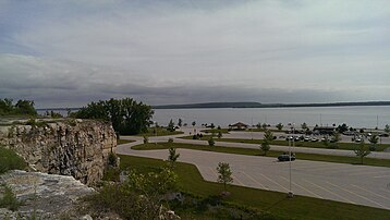
 Aerial view of Sturgeon Bay
 -
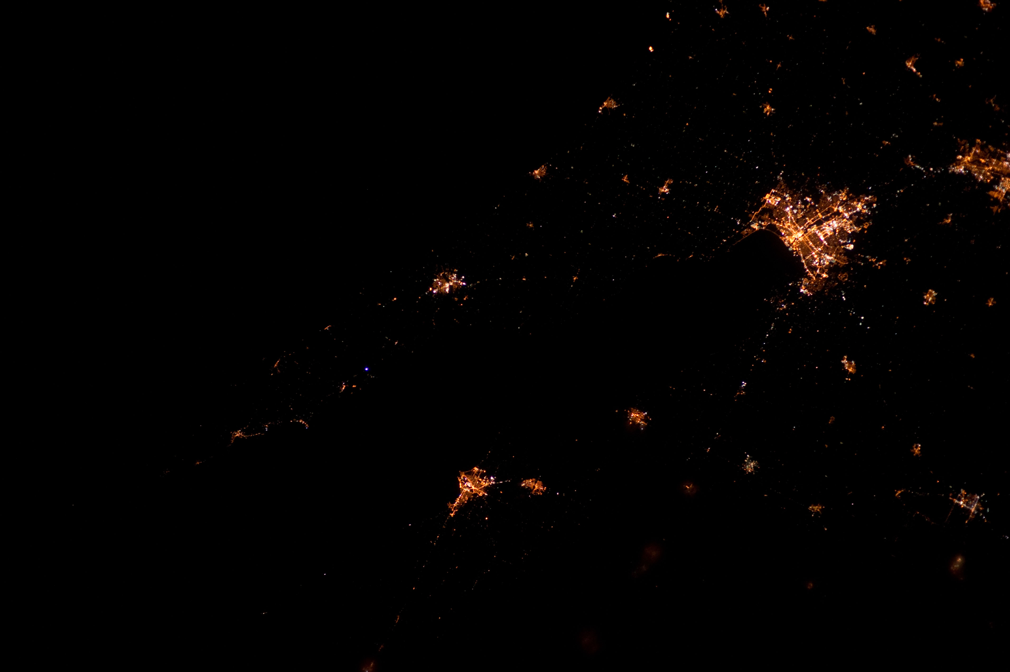
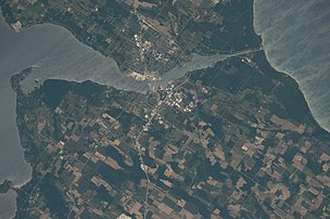 Taken June 20, 2016 from the International Space Station
 -
 Taken March 20, 2022 with Resourcesat-2; the path made by the icebreaker extends into the canal.
 -
 Taken March 28, 2022 with Resourcesat-2
 -
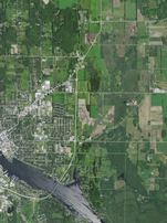
 Outer portion of the bay
 -
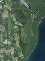
 Further into the bay
 -
 Inner portion of the bay
 -
 End of the bay and the connection with the Sturgeon Bay Ship Canal
 -
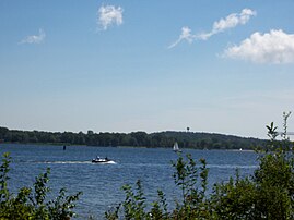 Looking southeast across Sturgeon Bay from Potawatomi State Park
 -
 Looking northeast at the mouth of Sturgeon Bay from Potawatomi State Park
 -
 View to the southwest across Sturgeon Bay to Cabot Point in the Idlewild area (background, right) and the bluff at Potawatomi State Park (background, center) from the Old Stone Quarry in Sevastopol; much of the quarry is now George K. Pinney County Park


Notes
- ^ "Sturgeon Bay (Wisconsin)". Geographic Names Information System. United States Geological Survey, United States Department of the Interior.
- ^ The Wisconsin Archeologist, Volume 19, No 2, page 50
- ^ The Physical Geography of Wisconsin by Lawrence Martin, Bulletin Number XXXVI, Educational Series Number 4, Madison Wisconsin: Wisconsin Geological and Natural History Survey, 1916 Chapter XII: The Wisconsin Coast of Lake Michigan, page 289
- ^ Kovalenko, Katya E.; Johnson, Lucinda B.; Brady, Valerie J.; Ciborowski, Jan J. H.; Cooper, Matthew J.; Gathman, Joseph P.; Lamberti, Gary A.; Moerke, Ashley H.; Ruetz, Carl R.; Uzarski, Donald G. (July 2, 2019). "Hotspots and bright spots in functional and taxonomic fish diversity". Freshwater Science. 38 (3): 480–490. doi:10.1086/704713. ISSN 2161-9549. S2CID 198274535.
- ^ Evolutionary trajectory of fish Piscine novirhabdovirus (=Viral Hemorrhagic Septicemia Virus) across its Laurentian Great Lakes history: Spatial and temporal diversification by Carol A. Stepien and Megan D. Niner, Ecology and Evolution, Volume 10, May 10, 2020, pages 9740–9775
- ^ Evaluation of lower Green Bay benthic fauna with emphasis on re-ecesis of Hexagenia mayfly nymphs by Jerry L. Kaster, Christopher M. Groff, J. Val Klump, Danielle L. Rupp, Suneil Iyer, Ashely Hansen, Samantha Barbour, and Louisa Hall, doi.org/10.1016/j.jglr.2018.06.006, Journal of Great Lakes Research (2018), p. 14
- ^ Dunlap Reef, Web-Map of Door County, Wisconsin
- ^ "NASA EarthData Search". NASA. Retrieved January 30, 2016.
- v
- t
- e
Great Lakes of North America
channels
| Erie | |
|---|---|
| Huron |
|
| Michigan |
|
| Ontario | |
| Superior | |
| St. Clair |
|
- Alliance for the Great Lakes
- Great Lakes and St. Lawrence Governors and Premiers
- Great Lakes Areas of Concern
- Great Lakes Basin Soil Erosion and Sediment Control Program
- Great Lakes Charter
- Great Lakes Commission
- Great Lakes Compact
- Great Lakes Environmental Research Laboratory
- Great Lakes Fishery Commission
- Great Lakes–Saint Lawrence River Basin Sustainable Water Resources Agreement
- International Joint Commission
- Municipalities
- Basin
- Chicago Yacht Club Race to Mackinac
- Circle Tour
- Crossings
- Great Loop
- Lake breeze
- Lake-effect snow
- Lake freighter
- Lake Michigan–Huron
- Lake Michigan Triangle
- Lake surfing
- Marine protected areas
- Marysburgh vortex
- Megalopolis
- Museum and historic ships
- Ports
- Region
- Laurentia
- Shipwrecks
- Storms
- Third Coast
- Treaties
 Lakes portal
| Authority control databases |
|
|---|
 | This article about a location in Door County, Wisconsin is a stub. You can help Wikipedia by expanding it. |
- v
- t
- e


