Steptoe Butte
Hill in Washington state, United States


U.S. National Natural Landmark
Steptoe Butte is a quartzite island jutting out of the silty loess of the Palouse hills in Whitman County, Washington, in the northwest United States. The 3,612-foot (1,101 m) butte is preserved as Steptoe Butte State Park, a publicly owned 150-acre (61 ha) recreation area located 12 miles (19 km) north of Colfax.[2]
Steptoe Butte and nearby Kamiak Butte comprise Steptoe and Kamiak Buttes National Natural Landmark. This 1,144-acre (463 ha) area, designated in 1965, includes land in state and county ownership.[3]
Geology
The rock that forms the butte is over 400 million years old, in contrast with the 15–7 million year old Columbia River Basalts that underlie the rest of the Palouse. Steptoe Butte has become an archetype, as isolated protrusions of bedrock, such as summits of hills or mountains, in lava flows have come to be called "steptoes".[2] Steptoe and Kamiak Buttes are outliers of Idaho's Coeur d'Alene Mountains.[3]
- Elevation: 3,612 feet (1,101 m) above sea level, approximately 1,000 feet (300 m) above the surrounding countryside (prominence).
- Visibility: Up to 70–100 miles (110–160 km). Mount Spokane is easily visible, 70 miles (110 km) to the north.[4]
History

The butte was named after Colonel Edward Steptoe.[2] A hotel built by James S. "Cashup" Davis stood atop the butte from 1888 to 1908, burning down in 1911.[5] In 1946, Virgil McCroskey donated 120 acres (49 ha) of land to form the park, which was later increased to over 150 acres (61 ha).[2] The east,south and west portions of the butte were purchased in 2016 by two couples Kent and Elaine Bassett, and Ray and Joan Folwell. The owners planned to protect their 437 acres (177 ha) of land from development, eventually donating it to the state.[6] This plan came to fruition when they sold the land to the Washington State Department of Natural Resources in December 2021.
Activities and amenities
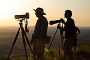
A narrow paved road winds around the butte, leading to a parking area at the summit. The park offers picnicking facilities and an interpretive wayside exhibit.[2] Popular activities include sight-seeing, paragliding, hang gliding, kite and model airplane flying, and photography.
Gallery
|


References
- ^ "Steptoe Butte State Park". Geographic Names Information System. United States Geological Survey, United States Department of the Interior.
- ^ a b c d e "Steptoe Butte State Park". Washington State Parks and Recreation Commission. Retrieved February 11, 2016.
- ^ a b "Steptoe and Kamiak Buttes". National Park Service. Retrieved June 24, 2022.
- ^ "Colfax - Steptoe Butte". Go Sleep. June 14, 2006. Archived from the original on June 23, 2006. Retrieved February 11, 2016.
- ^ Johnson, Randall A. (March 19, 2005). "Davis, James S. "Cashup" (1815-1896)". The Online Encyclopedia of Washington State History. HistoryLink. Retrieved August 27, 2018.
- ^ "Bellevue couple buy Steptoe Butte portion with aim of preservation". Spokesman-Review. Spokane, Wash. October 11, 2016. Retrieved August 27, 2018.
External links
Wikimedia Commons has media related to Steptoe Butte.
- Steptoe Butte State Park Heritage Site Washington State Parks and Recreation Commission
- Steptoe Butte State Park Map Washington State Parks and Recreation Commission
- v
- t
- e
Washington hills and ridges
Washington
| Yakima Fold Belt |
|
|---|---|
| Steptoes |
|
| Other |
Washington
| Pacific Coast Ranges incl. Olympic Mountains foothills |
|
|---|---|
| Other |
|
List of mountain ranges in Washington


