Saskatchewan Highway 60
Provincial highway in Saskatchewan, Canada
Highway 60 | ||||
|---|---|---|---|---|
| Route information | ||||
| Maintained by Ministry of Highways and Infrastructure | ||||
| Length | 23.2 km[1] (14.4 mi) | |||
| Major junctions | ||||
| North end |  Hwy 7 near Saskatoon Hwy 7 near Saskatoon | |||
| South end | Pike Lake Provincial Park | |||
| Location | ||||
| Country | Canada | |||
| Province | Saskatchewan | |||
| Rural municipalities | Corman Park, Vanscoy | |||
| Highway system | ||||
| | ||||
| ||||


Highway 60 is a provincial highway in the Canadian province of Saskatchewan. It runs from Highway 7 near Saskatoon to Pike Lake Provincial Park at Pike Lake. The speed limit is 90 km/h (55 mph). The highway is approximately 23 kilometres (14 mi) long.[1]
Highway 60 serves as a link connecting Saskatoon to Pike Lake Provincial Park, as well as acreages and businesses in the area. The Saskatchewan Railway Museum is located at the Hawker Siding about 3 kilometres (1.9 mi) from Highway 7. Hawker Siding was previously known as Eaton Siding.
Major intersections
From north to south:[2]
| Location | km[1] | mi | Destinations | Notes | |
|---|---|---|---|---|---|
| Corman Park No. 344 | 0.0 | 0.0 | Hwy 7 – Saskatoon, Rosetown | Northern terminus | |
| 11.0 | 6.8 |   Hwy 762 (Valley Road / Vanscoy Road) – Saskatoon, Vanscoy Hwy 762 (Valley Road / Vanscoy Road) – Saskatoon, Vanscoy | |||
| Vanscoy No. 345 | 21.0 | 13.0 |  Hwy 766 west – Delisle Hwy 766 west – Delisle | ||
| 23.2 | 14.4 | Pike Lake Provincial Park | |||
| 1.000 mi = 1.609 km; 1.000 km = 0.621 mi | |||||
Photo gallery
-
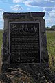 Bone Trail marker along Hwy 60
 -

-
 Eaton Internment Camp of World War I


See also
References
- ^ a b c Google (12 February 2018). "Highway 60 in Saskatchewan" (Map). Google Maps. Google. Retrieved 12 February 2018.
- ^ MapArt Publishing Corp. (2004). Saskatchewan Road Atlas (2007 ed.). Oshawa, ON: Peter Heiler Ltd. p. 32. ISBN 1-55368-020-0.
- v
- t
- e
- 600
- 601
- 602
- 603
- 604
- 605
- 606
- 607
- 608
- 609
- 610
- 611
- 612
- 613
- 614
- 615
- 616
- 617
- 618
- 619
- 620
- 621
- 622
- 623
- 624
- 626
- 627
- 628
- 629
- 630
- 631
- 632
- 633
- 634
- 635
- 636
- 637
- 638
- 639
- 640
- 641
- 642
- 643
- 644
- 645
- 646
- 647
- 648
- 649
- 650
- 651
- 653
- 654
- 655
- 656
- 657
- 658
- 659
- 660
- 661
- 662
- 663
- 665
- 665
- 667
- 668
- 669
- 670
- 671
- 672
- 673
- 674
- 675
- 676
- 677
- 678
- 679
- 680
- 681
- 682
- 683
- 684
- 685
- 686
- 687
- 688
- 689
- 690
- 691
- 692
- 693
- 694
- 695
- 696
- 697
- 698
- 699
- 700
- 701
- 702
- 703
- 704
- 705
- 706
- 707
- 708
- 709
- 711
- 713
- 714
- 715
- 716
- 717
- 718
- 719
- 720
- 721
- 722
- 724
- 725
- 726
- 727
- 728
- 729
- 730
- 731
- 732
- 733
- 734
- 735
- 737
- 738
- 740
- 741
- 742
- 743
- 744
- 745
- 747
- 748
- 749
- 751
- 752
- 753
- 754
- 755
- 756
- 758
- 759
- 760
- 761
- 762
- 763
- 764
- 766
- 767
- 768
- 769
- 771
- 772
- 773
- 774
- 776
- 777
- 778
- 779
- 780
- 781
- 782
- 783
- 784
- 785
- 786
- 787
- 788
- 789
- 790
- 791
- 792
- 793
- 794
- 795
- 796
- 797
- 798
- 799
 | This Saskatchewan road, road transport or highway-related article is a stub. You can help Wikipedia by expanding it. |
- v
- t
- e


