Netaji Subhas Chandra Bose Gomoh railway station
23°52′24″N 86°08′53″E / 23.8733°N 86.1481°E / 23.8733; 86.1481
Gomoh–Barkakana branch line,
Netaji S.C.Bose Gomoh–Hatia line,
Adra–Gomoh line
 Not Available
| Preceding station |  Indian Railways Indian Railways | Following station | ||
|---|---|---|---|---|
| Matari towards ? | East Central Railway zone | Nimiaghat towards ? | ||
| Terminus | East Central Railway zone | Telo towards ? | ||
Location | |
|---|---|
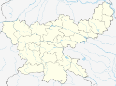
  Netaji Subhas Chandra Bose Gomoh Location within Jharkhand Show map of Jharkhand  Netaji Subhas Chandra Bose Gomoh Netaji Subhas Chandra Bose Gomoh (India) Show map of India |
Dhanbad–Koderma line | ||||||||||||||||||||||||||||||||||||||||||||||||||||||||||||||||||||||||||||||||||||||||||||||||||||||||||||||||||||||||||||||||||||||||||||||||||||||||||||||||||||||||||||||||||||||||||||||||||||||||||||||||||||||||||||||||||||||||||
|---|---|---|---|---|---|---|---|---|---|---|---|---|---|---|---|---|---|---|---|---|---|---|---|---|---|---|---|---|---|---|---|---|---|---|---|---|---|---|---|---|---|---|---|---|---|---|---|---|---|---|---|---|---|---|---|---|---|---|---|---|---|---|---|---|---|---|---|---|---|---|---|---|---|---|---|---|---|---|---|---|---|---|---|---|---|---|---|---|---|---|---|---|---|---|---|---|---|---|---|---|---|---|---|---|---|---|---|---|---|---|---|---|---|---|---|---|---|---|---|---|---|---|---|---|---|---|---|---|---|---|---|---|---|---|---|---|---|---|---|---|---|---|---|---|---|---|---|---|---|---|---|---|---|---|---|---|---|---|---|---|---|---|---|---|---|---|---|---|---|---|---|---|---|---|---|---|---|---|---|---|---|---|---|---|---|---|---|---|---|---|---|---|---|---|---|---|---|---|---|---|---|---|---|---|---|---|---|---|---|---|---|---|---|---|---|---|---|---|---|---|---|---|---|---|---|---|---|---|---|---|---|---|---|---|
Legend | ||||||||||||||||||||||||||||||||||||||||||||||||||||||||||||||||||||||||||||||||||||||||||||||||||||||||||||||||||||||||||||||||||||||||||||||||||||||||||||||||||||||||||||||||||||||||||||||||||||||||||||||||||||||||||||||||||||||||||
| ||||||||||||||||||||||||||||||||||||||||||||||||||||||||||||||||||||||||||||||||||||||||||||||||||||||||||||||||||||||||||||||||||||||||||||||||||||||||||||||||||||||||||||||||||||||||||||||||||||||||||||||||||||||||||||||||||||||||||
Sources:
| ||||||||||||||||||||||||||||||||||||||||||||||||||||||||||||||||||||||||||||||||||||||||||||||||||||||||||||||||||||||||||||||||||||||||||||||||||||||||||||||||||||||||||||||||||||||||||||||||||||||||||||||||||||||||||||||||||||||||||
Gomoh Junction, officially known as Netaji Subhas Chandra Bose Gomoh (station code is GMO), is a railway junction station in the Indian state of Jharkhand. Several branch lines start here: Gomoh–Barkakana branch line, Gomoh–Muri branch line and Adra–Gomoh line. It is located in Dhanbad district in the Indian state of Jharkhand.
Etymology
Gomoh railway station was renamed as Netaji Subhas Chandra Bose Gomoh railway station in 2009, in honour of Indian freedom fighter and leader Netaji's long journey in Netaji Express (previously known as Kalka Mail) from Gomoh Railway Station out of the British Empire in 1941.[1][2]
History
The Grand Chord was opened in 1906.[3] In 1927, the Central India Coalfields Railway opened the Gomoh–Barkakana line. Later, the line was amalgamated with East Indian Railway.[4] The construction of the 143-kilometre (89 mi) long Chandrapura–Muri–Ranchi–Hatia line started in 1957 and was completed in 1961.[5]
The Nagpur–Asansol line (then considered the main line of Bengal Nagpur Railway) was extended to Gomoh in 1907.[6]
Electrification
The Dhanbad–Gomoh sector was electrified in 1960−61.[7]
Loco shed
Gomoh Loco Shed has an electric loco shed with capacity to hold 125+ locos. Locos housed at the shed include 53-WAP-7 and 238-WAG-9 locomotives.[8]
References
- ^ "Railway's station tribute to Netaji". The Telegraph. 24 May 2008. Archived from the original on 29 April 2010. Retrieved 23 April 2013.
- ^ "Lalu salutes Netaji". The Telegraph. 24 January 2009. Archived from the original on 29 January 2009. Retrieved 23 April 2013.
- ^ "IR History – Part III (1900–1947)". IRFCA. Retrieved 23 April 2013.
- ^ "Indian Railway History Timeline". Archived from the original on 14 July 2012. Retrieved 26 August 2008.
- ^ Moonis Raza & Yash Aggarwal (1986). Transport Geography of India: Commodity Flow and the Regional Structure of Indian Economy. Concept Publishing Company, A-15/16 Commercial Block, Mohan Garden, New Delhi – 110059. ISBN 81-7022-089-0. Retrieved 20 April 2013.
{{cite book}}:|work=ignored (help) - ^ "Major Events in the Formation of S.E. Railway". South Eastern Railway. Archived from the original on 1 April 2013. Retrieved 23 April 2013.
- ^ "History of Electrification". IRFCA. Retrieved 20 April 2013.
- ^ "Sheds and Workshops". IRFCA. Retrieved 10 April 2013.
External links
- Trains at Chandrapura


