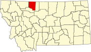
List of lakes of Toole County, Montana
Map all coordinates using OpenStreetMap
Download coordinates as:
- KML
- GPX (all coordinates)
- GPX (primary coordinates)
- GPX (secondary coordinates)
This list is incomplete; you can help by adding missing items. (February 2011) |
There are at least 63 named lakes and reservoirs in Toole County, Montana.
Lakes
- Alkali Lake, 48°56′10″N 111°25′57″W / 48.93611°N 111.43250°W / 48.93611; -111.43250 (Alkali Lake), el. 3,714 feet (1,132 m)[1]
- Aloe Lake, 48°37′24″N 112°00′14″W / 48.62333°N 112.00389°W / 48.62333; -112.00389 (Aloe Lake), el. 3,274 feet (998 m)[2]
- Benton Trail Lakes, 48°52′32″N 112°05′53″W / 48.87556°N 112.09806°W / 48.87556; -112.09806 (Benton Trail Lakes), el. 4,065 feet (1,239 m)[3]
- Big Lake, 48°56′18″N 111°28′01″W / 48.93833°N 111.46694°W / 48.93833; -111.46694 (Big Lake), el. 4,049 feet (1,234 m)[4]
- Cameron Lake, 48°50′51″N 111°25′33″W / 48.84750°N 111.42583°W / 48.84750; -111.42583 (Cameron Lake), el. 4,055 feet (1,236 m)[5]
- Cowboys Lake, 48°50′40″N 112°03′23″W / 48.84444°N 112.05639°W / 48.84444; -112.05639 (Cowboys Lake), el. 4,193 feet (1,278 m)[6]
- Davis Lakes, 48°52′53″N 112°04′23″W / 48.88139°N 112.07306°W / 48.88139; -112.07306 (Davis Lakes), el. 4,016 feet (1,224 m)[7]
- Fey Lakes, 48°56′28″N 111°26′48″W / 48.94111°N 111.44667°W / 48.94111; -111.44667 (Fey Lakes), el. 3,894 feet (1,187 m)[8]
- Fitzpatrick Lake, 48°53′38″N 112°10′06″W / 48.89389°N 112.16833°W / 48.89389; -112.16833 (Fitzpatrick Lake), el. 3,966 feet (1,209 m)[9]
- Fitzpatrick Lake, 48°53′55″N 111°17′00″W / 48.89861°N 111.28333°W / 48.89861; -111.28333 (Fitzpatrick Lake), el. 3,976 feet (1,212 m)[10]
- Foxtail Lakes, 48°52′00″N 112°05′48″W / 48.86667°N 112.09667°W / 48.86667; -112.09667 (Foxtail Lakes), el. 4,098 feet (1,249 m)[11]
- Frenchman Lake, 48°51′33″N 112°03′18″W / 48.85917°N 112.05500°W / 48.85917; -112.05500 (Frenchman Lake), el. 4,081 feet (1,244 m)[12]
- Goedertz Lake, 48°44′53″N 111°58′15″W / 48.74806°N 111.97083°W / 48.74806; -111.97083 (Goedertz Lake), el. 3,340 feet (1,020 m)[13]
- Hemmings Lake, 48°54′30″N 112°02′05″W / 48.90833°N 112.03472°W / 48.90833; -112.03472 (Hemmings Lake), el. 3,645 feet (1,111 m)[14]
- Jones Lake, 48°59′13″N 111°28′00″W / 48.98694°N 111.46667°W / 48.98694; -111.46667 (Jones Lake), el. 3,842 feet (1,171 m)[15]
- Long Lake, 48°50′16″N 112°09′19″W / 48.83778°N 112.15528°W / 48.83778; -112.15528 (Long Lake), el. 4,091 feet (1,247 m)[16]
- Mc Carters Lake, 48°31′10″N 111°24′14″W / 48.51944°N 111.40389°W / 48.51944; -111.40389 (Mc Carters Lake), el. 3,107 feet (947 m)[17]
- Moltz Lake, 48°55′33″N 111°29′05″W / 48.92583°N 111.48472°W / 48.92583; -111.48472 (Moltz Lake), el. 4,183 feet (1,275 m)[18]
- Mud Lake, 48°49′32″N 112°07′28″W / 48.82556°N 112.12444°W / 48.82556; -112.12444 (Mud Lake), el. 4,114 feet (1,254 m)[19]
- Perkins Lake, 48°54′56″N 111°41′52″W / 48.91556°N 111.69778°W / 48.91556; -111.69778 (Perkins Lake), el. 3,720 feet (1,130 m)[20]
- Ruby Johnson Lake, 48°56′22″N 111°26′38″W / 48.93944°N 111.44389°W / 48.93944; -111.44389 (Ruby Johnson Lake), el. 3,871 feet (1,180 m)[21]
- Swan Lake, 48°58′50″N 111°28′03″W / 48.98056°N 111.46750°W / 48.98056; -111.46750 (Swan Lake), el. 3,862 feet (1,177 m)[22]
- Twin Lakes, 48°55′38″N 111°27′33″W / 48.92722°N 111.45917°W / 48.92722; -111.45917 (Twin Lakes), el. 3,996 feet (1,218 m)[23]
- Twin Lakes, 48°54′34″N 112°02′38″W / 48.90944°N 112.04389°W / 48.90944; -112.04389 (Twin Lakes), el. 3,661 feet (1,116 m)[24]
- Verden Lake, 48°32′55″N 111°55′23″W / 48.54861°N 111.92306°W / 48.54861; -111.92306 (Verden Lake), el. 3,264 feet (995 m)[25]
- Virden Lake, 48°31′24″N 111°53′16″W / 48.52333°N 111.88778°W / 48.52333; -111.88778 (Virden Lake), el. 3,278 feet (999 m)[26]
Reservoirs
- Alkali Lake, 48°56′00″N 111°25′45″W / 48.93333°N 111.42917°W / 48.93333; -111.42917 (Alkali Lake), el. 3,717 feet (1,133 m)[27]
- Berkholder Reservoir, 48°42′55″N 111°17′22″W / 48.71528°N 111.28944°W / 48.71528; -111.28944 (Berkholder Reservoir), el. 3,619 feet (1,103 m)[28]
- Big Dam, 48°40′15″N 111°16′49″W / 48.67083°N 111.28028°W / 48.67083; -111.28028 (Big Dam), el. 3,497 feet (1,066 m)[29]
- Big Lake, 48°56′06″N 111°27′57″W / 48.93500°N 111.46583°W / 48.93500; -111.46583 (Big Lake), el. 4,075 feet (1,242 m)[30]
- Cameron Reservoir, 48°50′54″N 111°25′33″W / 48.84833°N 111.42583°W / 48.84833; -111.42583 (Cameron Reservoir), el. 4,094 feet (1,248 m)[31]
- Childers Reservoir, 48°34′18″N 111°20′33″W / 48.57167°N 111.34250°W / 48.57167; -111.34250 (Childers Reservoir), el. 3,297 feet (1,005 m)[32]
- Childrers Reservoir, 48°34′25″N 111°20′42″W / 48.57361°N 111.34500°W / 48.57361; -111.34500 (Childrers Reservoir), el. 3,294 feet (1,004 m)[33]
- Christian Lake, 48°56′30″N 111°19′57″W / 48.94167°N 111.33250°W / 48.94167; -111.33250 (Christian Lake), el. 3,753 feet (1,144 m)[34]
- Christian Reservoir, 48°56′30″N 111°19′59″W / 48.94167°N 111.33306°W / 48.94167; -111.33306 (Christian Reservoir), el. 3,753 feet (1,144 m)[35]
- Cook Reservoir, 48°59′08″N 111°19′11″W / 48.98556°N 111.31972°W / 48.98556; -111.31972 (Cook Reservoir), el. 3,599 feet (1,097 m)[36]
- D Ratzburg Reservoir, 48°15′36″N 111°35′21″W / 48.26000°N 111.58917°W / 48.26000; -111.58917 (D Ratzburg Reservoir), el. 3,461 feet (1,055 m)[37]
- Dunkirk Reservoir, 48°29′19″N 111°40′00″W / 48.48861°N 111.66667°W / 48.48861; -111.66667 (Dunkirk Reservoir), el. 3,255 feet (992 m)[38]
- Ed McIntyre Reservoir, 48°27′48″N 111°58′39″W / 48.46333°N 111.97750°W / 48.46333; -111.97750 (Ed McIntyre Reservoir), el. 3,432 feet (1,046 m)[39]
- Gillespie Reservoir, 48°27′15″N 111°17′24″W / 48.45417°N 111.29000°W / 48.45417; -111.29000 (Gillespie Reservoir), el. 3,173 feet (967 m)[40]
- Goeddertz Reservoir, 48°44′54″N 111°57′15″W / 48.74833°N 111.95417°W / 48.74833; -111.95417 (Goeddertz Reservoir), el. 3,330 feet (1,010 m)[41]
- Grassy Lake, 48°58′45″N 112°00′43″W / 48.97917°N 112.01194°W / 48.97917; -112.01194 (Grassy Lake), el. 3,432 feet (1,046 m)[42]
- Jim Judisch Reservoir, 48°18′54″N 111°37′45″W / 48.31500°N 111.62917°W / 48.31500; -111.62917 (Jim Judisch Reservoir), el. 3,501 feet (1,067 m)[43]
- Lake Shel-oole, 48°31′32″N 111°51′13″W / 48.52556°N 111.85361°W / 48.52556; -111.85361 (Lake Shel-oole), el. 3,340 feet (1,020 m)[44]
- M Ratzburg Reservoir, 48°15′00″N 111°37′45″W / 48.25000°N 111.62917°W / 48.25000; -111.62917 (M Ratzburg Reservoir), el. 3,465 feet (1,056 m)[45]
- MacHale Reservoir, 48°48′00″N 111°24′03″W / 48.80000°N 111.40083°W / 48.80000; -111.40083 (MacHale Reservoir), el. 3,835 feet (1,169 m)[46]
- Mary Reservoir, 48°43′06″N 111°22′03″W / 48.71833°N 111.36750°W / 48.71833; -111.36750 (Mary Reservoir), el. 3,586 feet (1,093 m)[47]
- McCarter Lake, 48°30′42″N 111°24′09″W / 48.51167°N 111.40250°W / 48.51167; -111.40250 (McCarter Lake), el. 3,097 feet (944 m)[48]
- McIntyre Reservoir, 48°28′30″N 111°18′19″W / 48.47500°N 111.30528°W / 48.47500; -111.30528 (McIntyre Reservoir), el. 3,202 feet (976 m)[49]
- McLean Reservoir, 48°41′06″N 112°04′15″W / 48.68500°N 112.07083°W / 48.68500; -112.07083 (McLean Reservoir), el. 3,386 feet (1,032 m)[50]
- Melcott Reservoir, 48°29′29″N 111°43′38″W / 48.49139°N 111.72722°W / 48.49139; -111.72722 (Melcott Reservoir), el. 3,294 feet (1,004 m)[51]
- Morris Reservoir, 48°48′30″N 111°19′15″W / 48.80833°N 111.32083°W / 48.80833; -111.32083 (Morris Reservoir), el. 3,937 feet (1,200 m)[52]
- Morris Reservoir, 48°53′00″N 111°17′39″W / 48.88333°N 111.29417°W / 48.88333; -111.29417 (Morris Reservoir), el. 4,071 feet (1,241 m)[53]
- Ovens Reservoir, 48°23′24″N 111°46′15″W / 48.39000°N 111.77083°W / 48.39000; -111.77083 (Ovens Reservoir), el. 3,084 feet (940 m)[54]
- Parsell Lake, 48°50′42″N 111°26′03″W / 48.84500°N 111.43417°W / 48.84500; -111.43417 (Parsell Lake), el. 4,039 feet (1,231 m)[55]
- Shay Reservoir, 48°31′00″N 111°26′39″W / 48.51667°N 111.44417°W / 48.51667; -111.44417 (Shay Reservoir), el. 3,163 feet (964 m)[56]
- Summers Reservoir, 48°29′38″N 111°46′57″W / 48.49389°N 111.78250°W / 48.49389; -111.78250 (Summers Reservoir), el. 3,386 feet (1,032 m)[57]
- Suphellen Reservoir, 48°44′30″N 111°40′21″W / 48.74167°N 111.67250°W / 48.74167; -111.67250 (Suphellen Reservoir), el. 3,402 feet (1,037 m)[58]
- The Pot Hole, 48°57′05″N 111°26′03″W / 48.95139°N 111.43417°W / 48.95139; -111.43417 (The Pot Hole), el. 3,743 feet (1,141 m)[59]
- Wanken Reservoir, 48°27′12″N 111°57′27″W / 48.45333°N 111.95750°W / 48.45333; -111.95750 (Wanken Reservoir), el. 3,412 feet (1,040 m)[60]
- Wilson Reservoir, 48°25′00″N 111°43′57″W / 48.41667°N 111.73250°W / 48.41667; -111.73250 (Wilson Reservoir), el. 3,333 feet (1,016 m)[61]
- Wood Reservoir, 48°50′18″N 111°29′27″W / 48.83833°N 111.49083°W / 48.83833; -111.49083 (Wood Reservoir), el. 3,573 feet (1,089 m)[62]
See also
Notes
- ^ "Alkali Lake". Geographic Names Information System. United States Geological Survey, United States Department of the Interior.
- ^ "Aloe Lake". Geographic Names Information System. United States Geological Survey, United States Department of the Interior.
- ^ "Benton Trail Lakes". Geographic Names Information System. United States Geological Survey, United States Department of the Interior.
- ^ "Big Lake". Geographic Names Information System. United States Geological Survey, United States Department of the Interior.
- ^ "Cameron Lake". Geographic Names Information System. United States Geological Survey, United States Department of the Interior.
- ^ "Cowboys Lake". Geographic Names Information System. United States Geological Survey, United States Department of the Interior.
- ^ "Davis Lakes". Geographic Names Information System. United States Geological Survey, United States Department of the Interior.
- ^ "Fey Lakes". Geographic Names Information System. United States Geological Survey, United States Department of the Interior.
- ^ "Fitzpatrick Lake". Geographic Names Information System. United States Geological Survey, United States Department of the Interior.
- ^ "Fitzpatrick Lake". Geographic Names Information System. United States Geological Survey, United States Department of the Interior.
- ^ "Foxtail Lakes". Geographic Names Information System. United States Geological Survey, United States Department of the Interior.
- ^ "Frenchman Lake". Geographic Names Information System. United States Geological Survey, United States Department of the Interior.
- ^ "Goedertz Lake". Geographic Names Information System. United States Geological Survey, United States Department of the Interior.
- ^ "Hemmings Lake". Geographic Names Information System. United States Geological Survey, United States Department of the Interior.
- ^ "Jones Lake". Geographic Names Information System. United States Geological Survey, United States Department of the Interior.
- ^ "Long Lake". Geographic Names Information System. United States Geological Survey, United States Department of the Interior.
- ^ "Mc Carters Lake". Geographic Names Information System. United States Geological Survey, United States Department of the Interior.
- ^ "Moltz Lake". Geographic Names Information System. United States Geological Survey, United States Department of the Interior.
- ^ "Mud Lake". Geographic Names Information System. United States Geological Survey, United States Department of the Interior.
- ^ "Perkins Lake". Geographic Names Information System. United States Geological Survey, United States Department of the Interior.
- ^ "Ruby Johnson Lake". Geographic Names Information System. United States Geological Survey, United States Department of the Interior.
- ^ "Swan Lake". Geographic Names Information System. United States Geological Survey, United States Department of the Interior.
- ^ "Twin Lakes". Geographic Names Information System. United States Geological Survey, United States Department of the Interior.
- ^ "Twin Lakes". Geographic Names Information System. United States Geological Survey, United States Department of the Interior.
- ^ "Verden Lake". Geographic Names Information System. United States Geological Survey, United States Department of the Interior.
- ^ "Virden Lake". Geographic Names Information System. United States Geological Survey, United States Department of the Interior.
- ^ "Alkali Lake". Geographic Names Information System. United States Geological Survey, United States Department of the Interior.
- ^ "Berkholder Reservoir". Geographic Names Information System. United States Geological Survey, United States Department of the Interior.
- ^ "Big Dam". Geographic Names Information System. United States Geological Survey, United States Department of the Interior.
- ^ "Big Lake". Geographic Names Information System. United States Geological Survey, United States Department of the Interior.
- ^ "Cameron Reservoir". Geographic Names Information System. United States Geological Survey, United States Department of the Interior.
- ^ "Childers Reservoir". Geographic Names Information System. United States Geological Survey, United States Department of the Interior.
- ^ "Childrers Reservoir". Geographic Names Information System. United States Geological Survey, United States Department of the Interior.
- ^ "Christian Lake". Geographic Names Information System. United States Geological Survey, United States Department of the Interior.
- ^ "Christian Reservoir". Geographic Names Information System. United States Geological Survey, United States Department of the Interior.
- ^ "Cook Reservoir". Geographic Names Information System. United States Geological Survey, United States Department of the Interior.
- ^ "D Ratzburg Reservoir". Geographic Names Information System. United States Geological Survey, United States Department of the Interior.
- ^ "Dunkirk Reservoir". Geographic Names Information System. United States Geological Survey, United States Department of the Interior.
- ^ "Ed McIntyre Reservoir". Geographic Names Information System. United States Geological Survey, United States Department of the Interior.
- ^ "Gillespie Reservoir". Geographic Names Information System. United States Geological Survey, United States Department of the Interior.
- ^ "Goeddertz Reservoir". Geographic Names Information System. United States Geological Survey, United States Department of the Interior.
- ^ "Grassy Lake". Geographic Names Information System. United States Geological Survey, United States Department of the Interior.
- ^ "Jim Judisch Reservoir". Geographic Names Information System. United States Geological Survey, United States Department of the Interior.
- ^ "Lake Shel-oole". Geographic Names Information System. United States Geological Survey, United States Department of the Interior.
- ^ "M Ratzburg Reservoir". Geographic Names Information System. United States Geological Survey, United States Department of the Interior.
- ^ "MacHale Reservoir". Geographic Names Information System. United States Geological Survey, United States Department of the Interior.
- ^ "Mary Reservoir". Geographic Names Information System. United States Geological Survey, United States Department of the Interior.
- ^ "McCarter Lake". Geographic Names Information System. United States Geological Survey, United States Department of the Interior.
- ^ "McIntyre Reservoir". Geographic Names Information System. United States Geological Survey, United States Department of the Interior.
- ^ "McLean Reservoir". Geographic Names Information System. United States Geological Survey, United States Department of the Interior.
- ^ "Melcott Reservoir". Geographic Names Information System. United States Geological Survey, United States Department of the Interior.
- ^ "Morris Reservoir". Geographic Names Information System. United States Geological Survey, United States Department of the Interior.
- ^ "Morris Reservoir". Geographic Names Information System. United States Geological Survey, United States Department of the Interior.
- ^ "Ovens Reservoir". Geographic Names Information System. United States Geological Survey, United States Department of the Interior.
- ^ "Parsell Lake". Geographic Names Information System. United States Geological Survey, United States Department of the Interior.
- ^ "Shay Reservoir". Geographic Names Information System. United States Geological Survey, United States Department of the Interior.
- ^ "Summers Reservoir". Geographic Names Information System. United States Geological Survey, United States Department of the Interior.
- ^ "Suphellen Reservoir". Geographic Names Information System. United States Geological Survey, United States Department of the Interior.
- ^ "The Pot Hole". Geographic Names Information System. United States Geological Survey, United States Department of the Interior.
- ^ "Wanken Reservoir". Geographic Names Information System. United States Geological Survey, United States Department of the Interior.
- ^ "Wilson Reservoir". Geographic Names Information System. United States Geological Survey, United States Department of the Interior.
- ^ "Wood Reservoir". Geographic Names Information System. United States Geological Survey, United States Department of the Interior.