Ivohibe
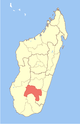
District in Ihorombe, Madagascar
22°21′S 45°49′E / 22.350°S 45.817°E / -22.350; 45.817 Madagascar
 (2018)Census
315
Ivohibe is a hilly town in Ihorombe Region in central Madagascar.
It is connected with Ihosy (110 km) in the west, and Farafangana (162 km) in the east by the largely unpaved Route nationale 27.
See also
Pic d'Ivohibe Reserve and the Andringitra National Park that are nearby.
22°11′S 46°28′E / 22.18°S 46.46°E / -22.18; 46.46
- v
- t
- e
Communes in the Ihorombe Region of the Republic of MadagascarCapital: Ihosy
- Andranombao
- Begogo
- Iakora
- Ranotsara Nord
- Volambita
- Antambohobe
- Ivohibe
- Ivongo
- Maropaika
- Antaramena
- Kotipa
3 districts; 31 communes
 | This Ihorombe location article is a stub. You can help Wikipedia by expanding it. |
- v
- t
- e


